√ Kefalonia villages |
The obelisk of Argostoli
|
 |
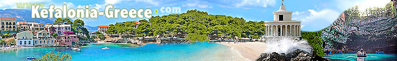
Kefalonia is by extension the fifth largest island in Greece, after Rhodes, Lesbos, Crete and Evia. Kefalonia has an international airport with lots of direct flights, especially charters, from many european countries. If you are traveling to Kefalonia is obviously easier to go by plane directly there, but you can also fly to Athens, Preveza (near Lefkada) or Zante and continue the journey with a domestic flight (Athens), bus (Athens and Preveza to Lefkada) or ferry (Lefkada and Zakynthos). Kefalonia has twelve villages with more than 500 residents, in addition there are many small villages. The island's capital is Argostoli, that is also the administrative, financial and cultural center. Most of the villages of Kefalonia were hit by a strong earthquake in 1953, which destroyed many houses and public buildings. The only village that was not touched by the earthquake is Fiscardo, on the north side of the island, standing out for its colored walls and the picturesque harbor. Founded in 1757 by the Venetians, Argostoli lost its characteristic traditional face after the earthquake of 1953. Around the daily market, on the shores of the gulf, the atmosphere looks like that of the 50s with simple and traditional buildings. A vague elegance is instead found in Platia Valianou square, the center of the walk after dinner. Argostoli extends over 2 km on the east bank of the peninsula of Lasi. Reinforced concrete buildings and old houses covered in red bricks stand on the low hill, while on the opposite side there are lots of tourist resorts and the nice beaches of Lasi. The long and narrow gulf which separates the peninsula from the center of the island and making Argostoli look like a town on a lake, is crossed by the road Drapano, built by the British in 1812. Nowadays the footbridge is so fragile that it can be crossed only by pedestrians, cyclists and fishermen. Landmarks in Argostoli: Archaeological Museum - The Library of Korgialenios - Agios Spiridonas - Napier's Park - Seawater Mills - The Lighthouse- The War Memorial Beaches near Argostoli: Makris Gialos beach - Platis Gialos beach - Tourkopodero After the returning of migrants to the country and thanks to many students, Lixouri has been extremly modernized. Several new buildings have been built with the many European funding. The center is the platia, the cobbled square with the impressive ficus near the new theater. By car you can discover the Paliki peninsula: first the beaches to the south, then across the mountains to the steep coast to the west, where the monastery of Kipourion stands out. Landmarks in Lixouri: Iakovatos Museum - The Monastery of Kipouria Beaches near Lixouri: Xi beach - Vatsa beach - Platia Ammos beach - Livadi beach - Petani beach In the late sixteenth century the whole peninsula was walled by the Venetians, in order to create a fortress to protect the inhabitants from the attack of enemies. In front of the peninsula stands the village of Assos, at the end of a narrow inlet. Although the beach is short and stony, the resort attracts many tourists due to the atmosphere that reigns in the cafes and taverns of the "square of Paris." The square was so called because the city of Paris had given consistent and effective aid to the people of this village, almost completely destroyed by the earthquake of '53. In fact, walking around the country you can still find many ruined old houses. Landmarks in Assos: The Castle Beaches near Assos: Myrtos beach Pines, olive trees and cypresses surround Fiscardo, and the walk to the harbour is forbidden to cars. You can swim from both the flat rocks along the harbour bay, and on the nearby pebbled beaches that can be reached on foot in 20 minutes. The town's name derives from the Norman leader Robert Guiscard, who made several raids in the Ionian Islands and who was struck by the plague in 1085 as he was about to attack again. Landmarks in Fiskardo: Norman Ruins Beaches near Fiskardo: Dafnoudi beach Landmarks in Sami: Ancient Sami - Melissani Cave - Drogarati Cave Beaches near Sami: Andisamos beach - Melissani Lake Landmarks in Kastro: Monastery of Agios Gerassimos - Fortress of Agios Georgios Landmarks in Livatho: Monastery of Agios Andreas Milapidias - Mycenaean tombs of Mazarakata (Tafi Mazarakaton) Beaches near Livatho: Porto Heli beach - Avithos beach - Ligia beach - Trapezaki beach Landmarks in Skala: Roman villa Beaches near Skala: Kaminia beach - Koroni beach Landmarks in Poros: Monastery of Theotokou Atrou - Mycenaean tomb of Tzanata (Tafi Tzanaton) |
Lixouri harbour
|
 |
|
The bay and the port of Fiskardo
|
 |
|
Beach and harbor of Assos
|
 |
|
View of the harbor of Sami from the ancient necropolis
|
 |
|
The village of Poros
|
 |
|
The mycenaean tomb of Mazarakata in Livatho
|
 |
|
about us | sitemap | advertising | contacts | disclaimer | links |