√ Kefalonia Island |
View of Assos harbour
|
 |
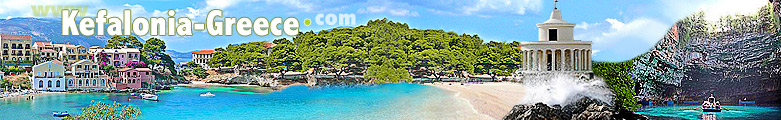
Kefalonia, the largest of Ionian Islands, located in the north-western coast of Greece, has a population of about 36,400 inhabitants and an area of 907 sq. km. Its long coastline extends for 237 km offering 39 beautiful pebbly and sandy beaches. The island of Kefalonia, unlike other Ionian Islands, offers a varied landscape both along its peninsulas and inlands. Dense fir woods on the slopes of Mount Enos, which with its 1628 meters is the highest mountain in the ionian archipelago. In other areas the landscape is less grassy and more wild, somewhere desert, with highlands and valleys born by erosion, as in the area of Lixouri. To the north, however, there are rolling hills covered with olive and cypress trees reminiscent of the Tuscan countryside. To the south, the flat coastal lowlands flanked by beaches remind of the nearby Peloponnese landscape. On the island there are also fascinating caves with stalactites and stalagmites, as well as monasteries, Venetian fortresses and wild rocky coasts. To the main body of the island are joined three peninsulas, which with their coasts and inlets give a specific character to Kefalonia. To the north, parallel to the island of Ithaca, there is the peninsula of Erissos, whose quiet villages are mainly located in mountainous areas. Just a 3 km long narrow sea separates Erissos from Ithaca. To the west, the peninsula of Paliki with Lixouri in the middle creates, with its extension, a long bay where all ferries are constantly shuttling between the two main towns: Lixouri and Argostoli. To the south-west there is the peninsula of Lasi whose entrance is the capital of Kefalonia: Argostoli with its gulf. Lassi, one of the main tourist resorts on the island, is located on the west coast, while the village of Skala, in the south of the island, is gradually stealing the record. Keep in mind that distances in Kefalonia are very long: between Poros, in the south, and Fiskardo, in the north, there are over 96km of bends, while Sami in the east is 44km far from Luxouri, in the west. However, there are bus connections between these places, but they are mostly fixed for the needs of locals rather than tourists, so it is perhaps preferable to travel by car, motorbike or, if you prefer, by kayak or sailing boat. Kefalonia has many beautiful beaches, bays and coves giving birth to its unusual shape, while the rocky coastline offers small and clean pebbly and sandy beaches. On the north-eastern coast of the island you can find Myrtos Bay with its beautiful white sandy beach made of coarse sand, pebbles and with a deep aquamarine sea. From here you can see the village of Assos, a small town situated at the bottom of a peninsula dominated by an imposing Venetian fortress. Further north there is the village of Fiscardo with its Venetian style and with a pretty harbor of fishing caiques, luxury yachts and cruise ships. The south coast boasts some of the most beautiful beaches mostly preferred by the famous "caretta-caretta" sea turtles, which are constantly monitored by a group of local turtle protection volunteers. |
Platia Ammos beach:
western coast of Paliki peninsula
|
 |
|
about us | sitemap | advertising | contacts | disclaimer | links |